Introducing The ForestBench Project
Community Engagement and Technological Innovation for Carbon Data Collection in the Global South.


In the realm of environmental science, accurate data is not just a luxury; it’s a necessity. This is particularly true when it comes to understanding the carbon content stored in the world’s forests—a critical factor in the global fight against climate change. Forests are the lungs of the Earth, absorbing carbon dioxide and releasing oxygen, thereby playing a pivotal role in climate regulation. However, existing data sets for estimating forest carbon content have been largely skewed towards the Global North. This bias leaves a glaring gap in our understanding of forests in the Global South, which are often rich in biodiversity and play a unique and pivotal role in carbon sequestration.
We here present the ForestBench project, which is designed to address this imbalance by gathering high-quality, “gold-standard” data from forests that have been historically underrepresented in global research. In this blog post, we introduce our community-driven approach, and take you on a tour around the world to our project sites. We want to share our many lessons learned here, both the technological and the cultural ones.
Methodological Innovation: A Dual Approach to Data Collection
What sets ForestBench apart is its comprehensive approach to data collection, which combines traditional ground-level measurements with state-of-the-art aerial drone technology. On the ground, the project involves the meticulous identification of tree species and the measurement of tree diameters—factors that are crucial for accurate carbon content estimation. Above the canopy, camera drones capture high-resolution data, providing a detailed layer of information.
To succeed in our combined approach, we included experts from many backgrounds in the project, working across disciplines to achieve a holistic data collection. For the drone imagery, we worked closely with local technology companies that offer drone-related services. The ground-level data collection on the other hand needed to be tuned towards each specific ecosystem, and so we invited local organizations that work on biodiversity, conservation, and restoration to collaborate with us. With these local experts on board, we could obtain unique data that takes the circumstances of each project site into account.
Community Engagement: Beyond Data Collection
While the collected scientific data are the core of ForestBench, what truly elevates the project is its commitment to community engagement and social responsibility. The initiative actively collaborates with local communities of Indigenous Peoples, who are the most knowledgeable about their local ecosystems but are rarely included in scientific research. ForestBench not only provides financial compensation for community participation but also emphasizes the transfer of knowledge and skills, thereby fostering a model of inclusive and sustainable scientific research.
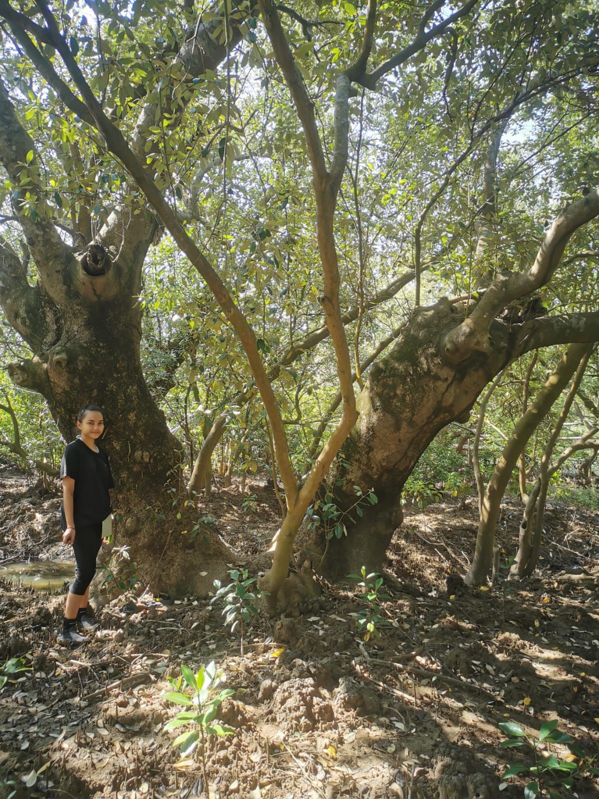
Exploring the Conservation and Restoration of Blue Carbon Habitats: A Dive into Mangrove Forests
In recent times, the importance of conserving and restoring our planet’s natural habitats has gained significant attention. Among these habitats, blue carbon ecosystems, particularly mangrove forests, have emerged as crucial players in the fight against climate change.
Oceanus Conservation is a non-profit organization that has dedicated its efforts towards the conservation and restoration of blue carbon habitats. Camille Rivera, the local project lead, along with her team, has been instrumental in collecting ground-level data. Their excellent work has been instrumental in collecting data on about 3,000 mangrove trees, including species identification and Diameter at Breast Height (DBH) of trees, ground-level photographs, and drone imagery. On top of that, the data is updated quarterly, ensuring that the information remains current and relevant to monitor the development of their conservation sites, such as the Cagwait Mangrove. This is pivotal in understanding the potential of future reforestation projects in mangrove forests, and would not have been possible without Camille and her team. From our perspective, this collaboration was the most fruitful and productive aspect of our project.

Adventures in Paraguay: A Journey of Collaboration and Conservation
The heart of South America, Paraguay, is a land of contrasts. From its bustling urban centers to the serene landscapes of the Chaco, it holds a myriad of fascinating places. Our collaboration with the Ministry of Environment of Paraguay unveiled some of these mysteries, offering us a unique perspective on the nation’s commitment to conservation.
A Warm Welcome from the Ministry
Our journey began with an invitation from the Ministry of Environment and Sustainable Development (MADES Paraguay) in February 2022. Eager to establish a relationship and facilitate local data collection for our project, we found ourselves in the company of passionate individuals dedicated to preserving Paraguay’s rich biodiversity. The meeting with the Minister and his team was enlightening. It became evident that Paraguay was keen on supporting our data collection efforts, especially in the face of an impending climate crisis that threatens the nation with heatwaves and drought.
Into the Wild: The Defensores del Chaco National Park
To our delight, the Ministry organized a field trip to the Defensores del Chaco National Park, the country’s largest national park. Within the larger Chaco region, this park is home to an old-growth semi-arid closed-canopy shrubland forest. This unique ecosystem, however, is under threat from rapid deforestation driven by agriculture and cattle farming.
Our visit to the park was both educational and experiential. We tested our drones and wildlife camera traps at the fringes of the pristine dry forest. The aerial photography provided invaluable above-canopy data, while ground-level data collection offered insights into the local biodiverisity. However, the slender and shrubby nature of the trees in this ecosystem presented challenges in measuring their properties.

A Lifelong Guardian: Don Silvino Gonzalez
One of the highlights of our trip was meeting Don Silvino Gonzalez, Paraguay’s most senior park ranger. A guardian of the forests, Don Silvino has dedicated his life to their protection. His insights into the natural history of the area were invaluable. Moreover, we were fortunate to use some of the land he owns near the park as one of our data collection sites for the ForestBench project.
Hope for Progress
Our adventures in Paraguay were a testament to the power of collaboration. The passion and commitment of the Ministry, the wisdom of Don Silvino Gonzalez, and the beauty of the Chaco have left an indelible mark on our hearts. As we move forward, we carry with us the lessons learned and the hope for a brighter, greener future for Paraguay. Since our initial visit to the Chaco, we have collected more aerial data from Don Silvino’s land, and continue to support the region through our project.
Brazil: Guardians of the Amazon - The Kayapo Indigenous People
Deep within the heart of the Amazon Rainforest, the Kayapo Indigenous People stand as guardians of over 9 million hectares of primary forest. This vast territory, equivalent in size to Portugal, is a biodiversity hotspot, home to numerous endangered species. The Kayapo, with their profound connection to the land, actively combat large-scale deforestation and external threats. Their efforts are not just about preserving an ecosystem; it’s about safeguarding their ancestral culture and way of life. While the Brazilian government’s regulations have limited the collection of forest carbon data, the Kayapo have generously provided wildlife imagery, offering a rare glimpse into the rich tapestry of life in the Amazon.

Bhutan: Planting a Million Dreams
In the serene landscapes of Bhutan, a monumental initiative is taking root. The Million Trees Project, supported by the Bhutan Ecological Society, has set forth an ambitious goal: to plant one million trees over five years. With an average target of 200 to 300 trees per acre, the focus is on high-value tree crops that can provide sustainable income for rural farmers through fruit production and other materials. Beyond the economic benefits, this project is a beacon of hope for biodiversity conservation in Bhutan, acting as a buffer against the impacts of climate change. The data from this project, including GPS coordinates and species information for almost 4,000 young trees, provides invaluable insights into reforestation efforts in the region and was collected at two locations.
Future Endeavors and Impact
The ForestBench initiative is a pioneering project that seeks to comprehensively gather data on the carbon content stored within forests, particularly in the Global South. All collected data will be published open-source, paving the way for future work to focus on its analysis. This data can be instrumental in our understanding of forest carbon stock, especially in the Global South. The project is more than just a scientific initiative; it is a paradigm shift in how we approach environmental research, community engagement, and climate action. By leveraging cutting-edge technology and fostering meaningful community partnerships, ForestBench is setting new benchmarks (pun intended) in the accurate measurement of forest carbon content. Its comprehensive and adaptable methodology has broad implications for climate science, policy-making, and sustainable development. We encourage you to visit the project website for more information.